Module:Location map/data/Африк/doc
This is the documentation page for Module:Location map/data/Африк
| нэр | Африк | ||
|---|---|---|---|
| x | 48.852459016393 + 71.1 * cos($1 * pi / 180) * sin(($2 - 15) * pi / 180) * (((1 + cos($1 * pi / 180) * cos(($2 - 15) * pi / 180)) * 0.5) ^ - 0.5 ) | ||
| y | 51.180555555556 - 75.3 * sin($1 * pi / 180) * (((1 + cos($1 * pi / 180) * cos(($2 - 15) * pi / 180)) * 0.5) ^ -0.5) | ||
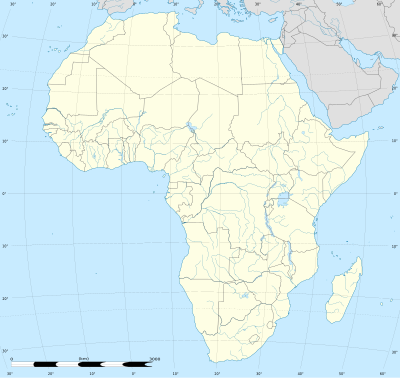
| зураг | Africa location map.svg
| ||

| |||
| image1 | Africa relief location map.jpg
| ||

| |||
| image2 | Africa_land_cover_location_map.jpg
| ||

| |||
Module:Location map/data/Африк нь "Африк"-ын тэгш өнцөгт проекц газрын зураг дээр тэмдэглэгээ, шошгыг давхарлахад ашигладаг байршлын газрын зургийн тодорхойлолт юм. Тэмдэглэгээг өгөгдмөл газрын зураг эсвэл ижил төстэй газрын зургийн зураг дээр өргөрөг, уртрагийн солбицолоор байрлуулна.
Хэрэглээ
Эдгээр тодорхойлолтыг "Африк" гэсэн параметрээр дуудахдаа дараах загваруудад ашигладаг:
{{Location map|Африк |...}}{{Location map many|Африк |...}}{{Location map+|Африк |...}}{{Location map~|Африк |...}}
Газрын зургийн тодорхойлолт
name = Африк- Газрын зургийн өгөгдмөл тайлбарт ашигласан нэр
image = Africa location map.svg- "Зураг:" эсвэл "Файл:" байхгүй өгөгдмөл газрын зургийн зураг
image1 = Africa relief location map.jpg- 'Relief эсвэл AlternativeMap параметрээр харуулах боломжтой газрын зургийн өөр зураг, ихэвчлэн газар нутгийн газрын зураг
image2 = Africa_land_cover_location_map.jpg- Alternative map image which can be displayed via the AlternativeMap parameter
x = 48.852459016393 + 71.1 * cos($1 * pi / 180) * sin(($2 - 15) * pi / 180) * (((1 + cos($1 * pi / 180) * cos(($2 - 15) * pi / 180)) * 0.5) ^ - 0.5 )- An expression to calculate a location on the map via its longitude; evaluates as 0 along the left edge and 100 along the right edge
y = 51.180555555556 - 75.3 * sin($1 * pi / 180) * (((1 + cos($1 * pi / 180) * cos(($2 - 15) * pi / 180)) * 0.5) ^ -0.5)- An expression to calculate a location on the map via its latitude; evaluates as 0 along the top edge and 100 along the bottom edge
Өөр газрын зураг
{{Location map}}, {{Location map many}}, болон {{Location map+}} загварууд нь өөр газрын зургийн зургийг зааж өгөх параметртэй. Image1 хэлбэрээр харуулсан газрын зургийг рельеф эсвэл AlternativeMap параметрээр ашиглаж болно. The map displayed as image2 can be used with the AlternativeMap parameter. Жишээг доороос эсвэл доороос олж болно.:
Байршлын газрын зургийн загварыг ашиглах жишээ
Location map, using default map (image)
{{Location map | Африк
| width   = 200
| label   = Каир
| lat_deg = 30.06
| lon_deg = 31.23
}}
Location map many, using relief map (image1)
{{Location map many | Африк
| relief   = yes
| width    = 200
| caption  = Африк дахь хоёр байршил
| label1   = Каир
| lat1_deg = 30.06
| lon1_deg = 31.23
| label2   = Лагос
| lat2_deg = 6.45
| lon2_deg = 3.40
}}
Location map+, using AlternativeMap
{{Location map+ | Африк
| AlternativeMap = Africa relief location map.jpg
| width   = 200
| caption = Африк дахь хоёр байршил
| places  =
  {{Location map~ | Африк
  | label   = Каир
  | lat_deg = 30.06
  | lon_deg = 31.23
  }}
  {{Location map~ | Африк
  | label   = Лагос
  | lat_deg = 6.45
  | lon_deg = 3.40
  }}
}}
Мөн үзэх
Байршлын газрын зургийн загварууд
- Загвар:Location map, өргөрөг, уртраг ашиглан нэг тэмдэг, шошгыг харуулах
- Загвар:Location map many, ес хүртэлх тэмдэг, шошго харуулах
- Загвар:Location map+, хязгааргүй тооны тэмдэг, шошгыг харуулах