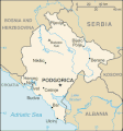
Файл:Montenegro-map.gif
Montenegro-map.gif (325 × 349 пиксел, файлын хэмжээ: 18 КБ, MIME төрөл: image/gif)
Файлын түүх
Огноо/цаг дээр дарж тухайн үеийнх нь файлын байдлыг харна уу.
| Огноо/Цаг | Жижиг зураг | Хэмжээ | Хэрэглэгч | Тайлбар | |
|---|---|---|---|---|---|
| одоогийн | 07:38, 19 Хоёрдугаар сар 2022 |  | 325 × 349 (18 КБ) | Lojwe | Cropped 2 % horizontally, 1 % vertically using CropTool with precise mode. |
| 20:31, 25 Гуравдугаар сар 2008 |  | 330 × 353 (19 КБ) | Camptown~commonswiki | == Summary == {{Information |Description=Map of Montengro |Source=[https://www.cia.gov/library/publications/the-world-factbook/geos/mj.html Montenegro] |Date=2008-03-25 |Author=Central Intellegence Agency |Permission=PD US-gov |other_versions= }} == [[Co | |
| 09:32, 11 Наймдугаар сар 2006 |  | 330 × 353 (15 КБ) | Rémih | *Description:Carte du Monténégro indépendant *Source:[https://www.cia.gov/cia/publications/factbook/geos/mj.html CIA WorldFactBook] category:Maps of Montenegro {{PD-USGov-CIA-WF}} |
Холбоос
Энэ файлд холбоос хийсэн хуудас байхгүй байна.
Файлын хэрэглээ (бүх төсөл)
Дараах бусад вики энэ файлыг ашигладаг:
- azb.wikipedia.org дахь хэрэглээ
- bs.wikipedia.org дахь хэрэглээ
- cs.wikipedia.org дахь хэрэглээ
- cs.wikinews.org дахь хэрэглээ
- en.wikipedia.org дахь хэрэглээ
- fr.wikipedia.org дахь хэрэглээ
- gag.wikipedia.org дахь хэрэглээ
- hu.wikipedia.org дахь хэрэглээ
- hu.wiktionary.org дахь хэрэглээ
- ig.wikipedia.org дахь хэрэглээ
- it.wikipedia.org дахь хэрэглээ
- mr.wikipedia.org дахь хэрэглээ
- sl.wikipedia.org дахь хэрэглээ
- tr.wiktionary.org дахь хэрэглээ
- uk.wikipedia.org дахь хэрэглээ


