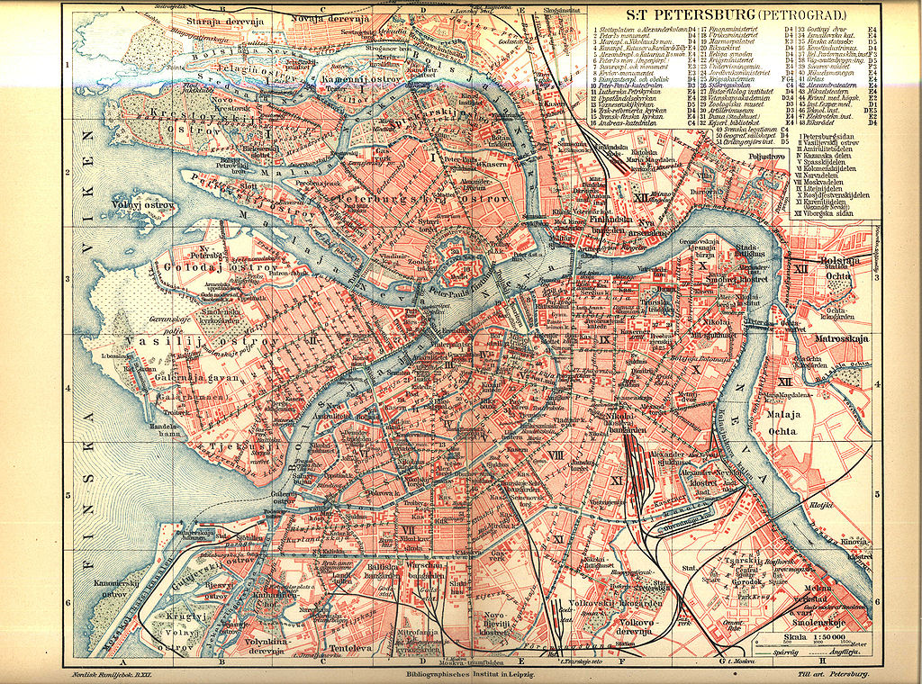
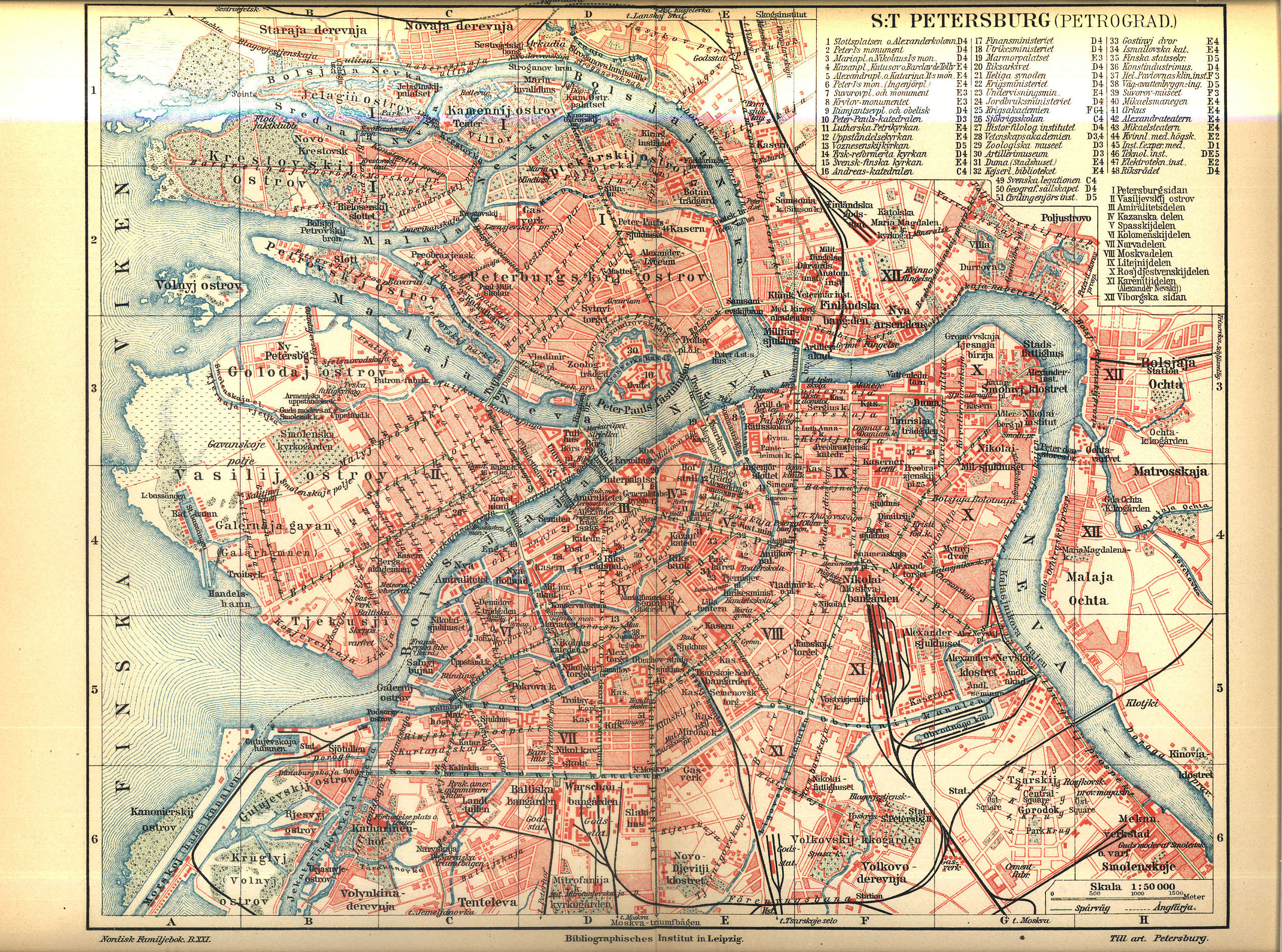
Файл:Karta över Sankt Petersburg på 1910-talet (ur Nordisk familjebok).jpg

Үзлэгийн хэмжээ : 800 × 594 пиксел Бусад зургын нягтрал: 320 × 238 пиксел | 640 × 475 пиксел | 1,024 × 760 пиксел | 1,280 × 950 пиксел | 2,560 × 1,901 пиксел | 3,432 × 2,548 пиксел.
Эх файл (3,432 × 2,548 пиксел, файлын хэмжээ: 2.2 МБ, MIME төрөл: image/jpeg)
Товч агуулга
| Тайлбар |
English: Map of Saint Petersburg between 1911 and 1915
Svenska: Karta över Sankt Petersburg på 1910-talet
Русский: Карта Санкт-Петербурга. Между 1911 и 1915. |
||||||||
| Огноо | ᠑,᠙᠑᠑.᠐ - ᠑,᠙᠑᠕.᠐ (1911 - opened Peter the Great Bridge over Neva River; 1915 — published volume 21 «Papua - Posselt» of Nordisk familjebok) | ||||||||
| Эх үүсвэр | Nordisk familjebok | ||||||||
| Зохиогч |
English: Сonsociation "Prosveschenie", Saint Petersburg Русский: Товарищество "Просвещение", Санкт-Петербург |
||||||||
| Зөвшөөрөл (Энэ файлыг дахин ашиглах) |
|
||||||||
| Other versions | spkarta.ru, |


.jpg)
| Open this image as an overlay in Google Earth (Google Maps, Bing) | (Help|Source) |
.jpg/overlay.kml)
Файлын түүх
Огноо/цаг дээр дарж тухайн үеийнх нь файлын байдлыг харна уу.
| Огноо/Цаг | Жижиг зураг | Хэмжээ | Хэрэглэгч | Тайлбар | |
|---|---|---|---|---|---|
| одоогийн | 22:09, 26 Дөрөвдүгээр сар 2005 | | 3,432 × 2,548 (2.2 МБ) | Den fjättrade ankan~commonswiki | *{{Svenska}} Karta över Sankt Petersburg på 1910-talet *{{English}} Map of Saint Petersburg at the 1910s *Source: Nordisk familjebok {{PD-Ugglan}} Category:Saint Petersburg, Russia Category:20th century maps |
Холбоос
Дараахь хуудсууд уг файлтай холбогдсон байна:
Файлын хэрэглээ (бүх төсөл)
Дараах бусад вики энэ файлыг ашигладаг:
- br.wikipedia.org дахь хэрэглээ
- es.wikipedia.org дахь хэрэглээ
- fi.wikipedia.org дахь хэрэглээ
- fr.wikipedia.org дахь хэрэглээ
- gl.wikipedia.org дахь хэрэглээ
- hy.wikipedia.org дахь хэрэглээ
- ja.wikipedia.org дахь хэрэглээ
- no.wikipedia.org дахь хэрэглээ
- ro.wikipedia.org дахь хэрэглээ
- sv.wikipedia.org дахь хэрэглээ
.jpg)