Файл:Grenada-map.png
Үзлэгийн хэмжээ : 484 × 600 пиксел Бусад зургын нягтрал: 194 × 240 пиксел | 387 × 480 пиксел | 961 × 1,191 пиксел.
Эх файл (961 × 1,191 пиксел, файлын хэмжээ: 192 КБ, MIME төрөл: image/png)

|
This map image could be re-created using vector graphics as an SVG file. This has several advantages; see Commons:Media for cleanup for more information. If an SVG form of this image is available, please upload it and afterwards replace this template with
{{vector version available|new image name}}.
It is recommended to name the SVG file “Grenada-map.svg”—then the template Vector version available (or Vva) does not need the new image name parameter. |
| Тайлбар |
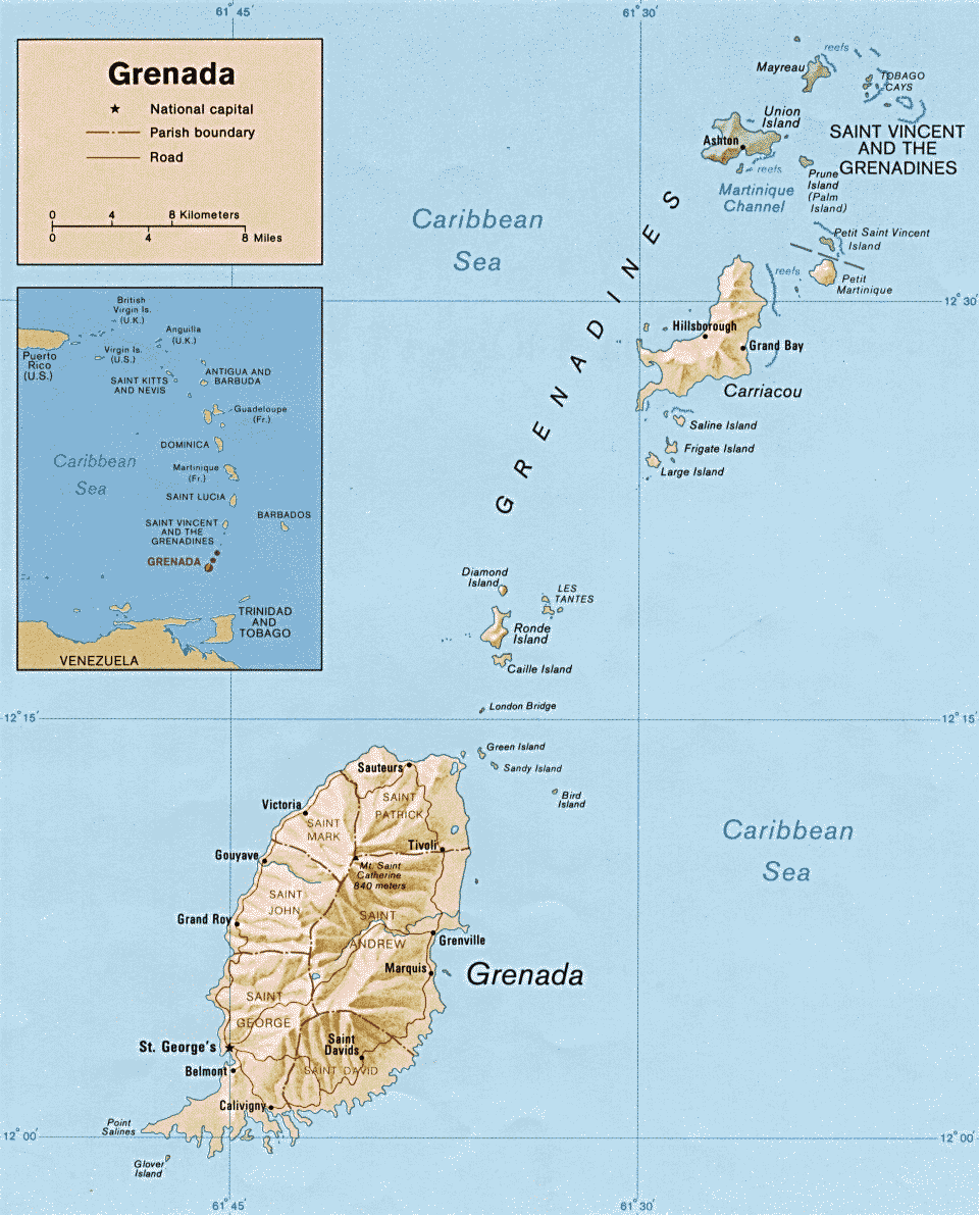
English: Map of Grenada |
|||
| Огноо | ||||
| Эх үүсвэр | http://www.lib.utexas.edu/maps/americas.html | |||
| Зохиогч | CIA | |||
| Зөвшөөрөл (Энэ файлыг дахин ашиглах) |
|

Файлын түүх
Огноо/цаг дээр дарж тухайн үеийнх нь файлын байдлыг харна уу.
| Огноо/Цаг | Жижиг зураг | Хэмжээ | Хэрэглэгч | Тайлбар | |
|---|---|---|---|---|---|
| одоогийн | 02:12, 17 Гуравдугаар сар 2009 | | 961 × 1,191 (192 КБ) | Sasha Krotov | {{Information |Description=Map of Grenada |Source=http://www.lib.utexas.edu/maps/americas.html |Date=1990 |Author=CIA |Permission={{PD-USGov-CIA}} |other_versions= }} Category:Maps of Grenada <!--{{ImageUpload|basic}}--> |
Холбоос
Дараахь хуудсууд уг файлтай холбогдсон байна:
Файлын хэрэглээ (бүх төсөл)
Дараах бусад вики энэ файлыг ашигладаг:
- als.wikipedia.org дахь хэрэглээ
- be.wikipedia.org дахь хэрэглээ
- en.wikipedia.org дахь хэрэглээ
- es.wikipedia.org дахь хэрэглээ
- fa.wikipedia.org дахь хэрэглээ
- fi.wikipedia.org дахь хэрэглээ
- fo.wikipedia.org дахь хэрэглээ
- fr.wikipedia.org дахь хэрэглээ
- fr.wikivoyage.org дахь хэрэглээ
- fr.wiktionary.org дахь хэрэглээ
- he.wikipedia.org дахь хэрэглээ
- id.wikipedia.org дахь хэрэглээ
- io.wikipedia.org дахь хэрэглээ
- mad.wikipedia.org дахь хэрэглээ
- mg.wikipedia.org дахь хэрэглээ
- mk.wikipedia.org дахь хэрэглээ
- pl.wikipedia.org дахь хэрэглээ
- ru.wikipedia.org дахь хэрэглээ
- tr.wikipedia.org дахь хэрэглээ
- tr.wiktionary.org дахь хэрэглээ
- tt.wikipedia.org дахь хэрэглээ
- uk.wikipedia.org дахь хэрэглээ
- www.wikidata.org дахь хэрэглээ
- zh.wikipedia.org дахь хэрэглээ